Whatever Strikes my Fancy.
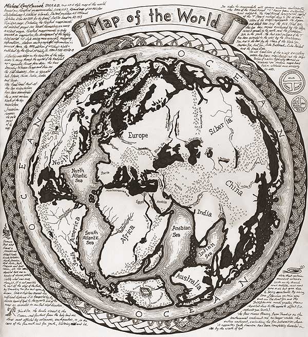
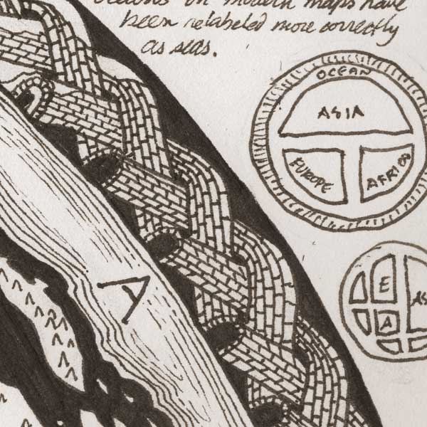
I've just completed this slightly lunatic endeavour, a hypothetical extension of the "T-O" map tradition. T-O maps were an abstracted map style used around the time of the Crusades to symbolically represent the relationship of the then three known continents of Europe, Africa and Asia. The detail below shows a typical T-O map. The centre of these maps is Jerusalem, the head of the T is the Aegean, Bosporus, Black Sea to the left, Nile and Red Sea to the right, and the column of the T is the Mediterranean. The O is the Ocean encircling all the land. Later T-O maps began to cram more information about geographic realities into the format, but eventually this tradition was entirely replaced by the much more practical nautical chart-making tradition that all modern maps are descended from.
|
The notes around the map explain things like what source maps were used, how it possible to get from North America to Asia over the Ocean on a flat earth without sailing off (divine portals represented by the knotted tunnels around the map), and why the Pacific Rim is prone to earthquakes and volcanoes (because, of course, these lands are furthest from the Holy Land in this format).
|
Oringinal post: http://mbarrick.livejournal.com/821300.html