Whatever Strikes my Fancy.
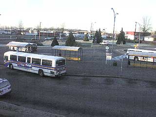
After catching my bus it travels down the mountian. This is the Phibbs Exchange, the last stop before crossing the "Ironworkers Memorial Bridge" which is commonly known as the second narrows bridge. The official name is in memory on 19 men who died when a span of the bridge collapsed during construction due to a misplaced decimal point by one of the engineers. If you are wondering "How can one misplace a decimal point?" you are too young to remember slide-rules.
|
 |
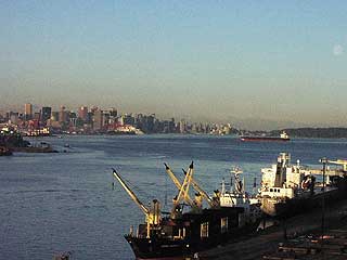
 These are the north shore shipyards. In the original colonial plan North Vancouver was going to be the main city and, given the importance of shipyards to the British colonial powers, these were built here. Then Gassy Jack build a pub on the south side of the Burrard inlet, close to the Hastings Mill, making Vancouver a much more desirable place for the loggers and sailors to stay. Most of these early roustabouts built their homes off the log-paved courderoy road used to drag logs to the mill, the "skid road". In British English a street with a line of building on either side is a "row", thus the term "skid row".
 |
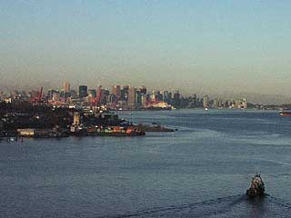
Vancouver from the second narrows bridge. Vancouver itself may have remained an exclusively the domain of the blue-collar worker if it weren't for the last-minute decision to make ti the terminus for the transcontinental railway. Originally the railway was to end in Victoria, with the main line going along the north shore, up Howe Sound, through the mountains, out along the Bute Inlet, and across Discover Passage to Vancouver Island, then down following the route of what is now the E&N Railway.
|
Well, "trought the mountains", as was discovered when trying to get through the Rockies, is a hell of a lot easier said than done. So Canadian Pacific bagged it. They decided Port Moody was going to be the end of the line. A bunch of people bought up land in Port Moody thinking it was going to be worth a lot later. Then CP decided Port Moody didn't have enough space to grow and since they were going to have to build a spur to Vancouver anyway for the lumber, may as well make it the terminal city. And now you know where the nickname "Terminal City" comes from for Vancouver.
|
 |
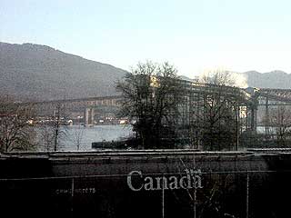 |
The is looking back at the second narrows bridge. Through the trees is the Alberta Wheat Pool, with a Canadian Wheat Board rail car in the foreground.
|
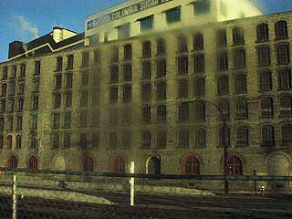
With the terminal on the south shore the people and industry naturally followed. This is the B.C. Sugar (Roger's Sugar) factory, which is one of oldest, if not the oldest, industrial buildings in Vancouver. I have a reprint of a map of Vancouver from 1898 that clearly shows this building.
|
 |
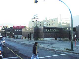 |
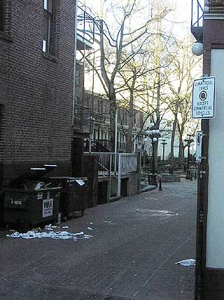
Here we are in the heart of skid row. This is Mike's parents' store. I used to live at the end of this street, right up against the railyard in a building that was converted from an abandoned cold-storage warehouse (built in 1931) to artist-live/work studios. The street my building was on, uncleverly named "Railway Street", actually still has the wooden cobbles underneath the pavement. While my apartment itself was great (I loved the trains and could tolerate the crack-whores and herion addicts in the alley) I was driven out by noisy neighbours.
|
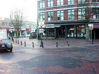
And now we briefly exit skid-row and pass through the edge of the "touristy" part of Gastown. In the mid-1970's this area was as much of a dive as the areas to the east of Main St., but was turned into a tourist trap/entertainment area. To the left of the picture is the building that houses Sanctuary (the building with the purplish awning) and to the right, just behind the "do not enter" sign is the doorway to what was once the now infamous "Twilight Zone".
|
 |
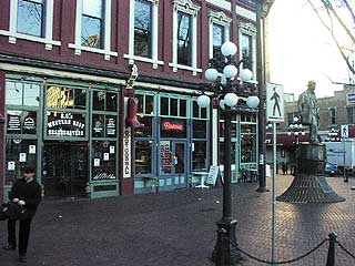 |
And here is Vancouver's oldest brick building. This building was constructed using left-over ballast brinks unloaded from ships coming from the far east for lumber. The statue of the man standing on the beer keg is our (ig)noble founding father, Gassy Jack. Behind the statue you can again see the Purple Onion, home of Sanctuary Sundays.
|
Here is Blood Alley, onto which the back balcony of Club 23 West, home of Sin City faces (visible behind the trees). This alley is so named because the building the corner of which is visible to the right used to be home to Vancouver's first jail. This alley was were the gallows were. Between the building housing the old jail and the old brick building in the previous image, and some of the surrounding buildings is a small courtyard named "Gaolers Mews", also for the jail. The pub my friend Brenda and I go to Friday afternoons has its restrooms in what used to be the jail.
|
 |
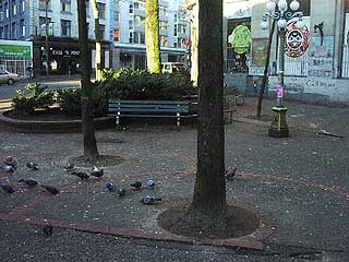 |
And here we've again exited the tourist part of Gastown and are in the very worst part of town. The odd little corner park, the reason for its exisitence being an odd diagonal gap cutting trough several blocks of this section of town (which I'll explain later), is "Pigeon Park". This park is home to those that have sunk well below what most would call rock bottom. In the doorways of the building in behind the park on any given morning I see people huddled with crack pipes or the heroin needles. Later in the day they will move onto these benches. It is not uncommon to see lean-to shanties against the building. This is where crack and smack gets you: sleeping outside in pigeon shit.
|
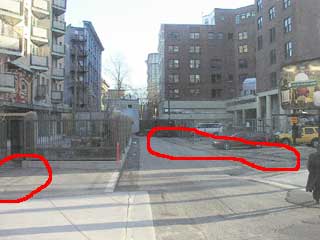 |
This is the reason for the odd diagonal gap. If you look carefully at the areas I have circled you can see the remains of a railway. This gap is a Canadian Pacific right-of-way. These rails used to connect the Gastown railyard with the False Creek railyard (the only remnant of which is the Roundhouse, which is now a community centre and museum). This spur was later replaced by a tunnel under the city connecting the other end of the Gastown railyard (the Coal Harbour end) to the newer, larger railyard at the head of False Creek. That tunnel is now used by the Skytrain (the section between Waterfront Station, which is the old termnial station for the transcontinental railway, and Stadium Station. Opposite where I am facing to take this picture is the mall which contains the Tinseltown Cinemas. The mall has a large, wide gallery that, in fact, is part of this right-of-way.
|
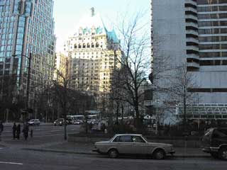
From the cut the bus heads into downtown, past the stock exchange and reaching its last stop in the heart of the financial district. Here is the Hotel Vancouver (heart of the Turkey Conspiracy), with Burrard Station to the right (the white pipes). Burrard Station is part of the tunnel mentioned above.
|
 |
Oringinal post: http://mbarrick.livejournal.com/197450.html